Welcome to SkydioPilots.com
Sign up and join the discussion!
Sign up

Technical discussion about the new KeyFrame skill

Here is a portion of the Keyframe test I did yesterday. The first half of the video is sped up four times while I set up the waypoints/keyframes. The second half of the video shows how the Skydio shifted my path toward the riverbank which put the drone in danger of hitting a great number of trees. Also note the starting position of the Skydio 2 and how the end point moved by approximately 75ft.

Great vid. It seems odd that the sequence ended up far away from where it started. I couldn’t quite figure out where the start and end points actually were.

The first frames of the vid show a sign post and what looks like a plastic pipe sticking up so good reference point.

Was that your takeoff - home point?

If so did you fly very far from there before you set the first keyframe?

On the rewind how far past the signpost did it go?

 
The first keyframe was in the middle of the river. On rewind it went 75 ft past the initial launch point. Clearly still pretty buggy.
 
The first keyframe was in the middle of the river. On rewind it went 75 ft past the initial launch point. Clearly still pretty buggy.
Just a suggestion but if you screen recorded the setup part you could reference where the key frames were set to the end video product and maybe figure out what works best.

It looks like you launched at that signpost, flew out to the middle and paused as I assume that was the first keyframe. You then flew down the stream and it looked like you set a few more until you reached the fork and then went left and flew up that section until you set the last one. On return it seemed to be OK until the fork and then if flying backwards it went to its right farther than the setup path but that might have been a straight line path between the keyframe at the fork and where it considered the next one was. That happened to be close to the bank and trees but if my theory about straight line is true it just used it’s OA to deal with what came along.

Why it overshot the first one is a headscratcher for sure.

But man can you run!!!(y):)
 
  • Like
Reactions: Saladshooter
I saw today in a Skydio Flight School? video they mention keeping your 1st keyframe as close to your launchpoint as possible to help assure an accurate flight path. Could help explain the deviation.
 
  • Like
Reactions: Saladshooter
It looks like you launched at that signpost, flew out to the middle and paused as I assume that was the first keyframe. You then flew down the stream and it looked like you set a few more until you reached the fork and then went left and flew up that section until you set the last one. On return it seemed to be OK until the fork and then if flying backwards it went to its right farther than the setup path but that might have been a straight line path between the keyframe at the fork and where it considered the next one was. That happened to be close to the bank and trees but if my theory about straight line is true it just used it’s OA to deal with what came along.
All of my Keyframes were set in the middle of the river so the Skydio would have no reason to approach the riverbank or have anything in the way to use OA. And there is no reason for it to blow past my first Keyframe in the middle of the river go through my initial launch point and then add another 75ft so it end up in the woods.

I have a few things to test but its about 10° F here at the moment. One is because you can set Keyframes inside, it doesn't rely solely on GPS, if the drone is using other methods outdoors as well.... water and snow are not great features for the Skydio to get an accurate picture of the world from and could be causing the errors.

Second; I have pretty much just put the drone in the sky and started setting up Keyframes. There is a possibility that I am not letting the Skydio get good enough satellite lock before laying out the points. Because I am flying below 30ft, the Skydio doesn't protest when you don't have good GPS. This is more a function of the cold weather than my laziness.... I like to get my birds in the air and get my flights done rather quickly this time of year.
 
I saw today in a Skydio Flight School? video they mention keeping your 1st keyframe as close to your launchpoint as possible to help assure an accurate flight path. Could help explain the deviation.
This is helpful. I watched the video and will make the first keyframe my launch position next time. I can tell you from my first day experience(Not the flight in my video!) that if you are going to use the launch point as the first Keyframe then you need to place some nearby Keyframes to clearly define the path of the Skydio. Without some closely placed Keyframes to the launch point the Skydio will try to find its way back to you through the woods.

I'm posting the mentioned video below to help others:

Your idea of it not having a good lock on its surroundings
All of my Keyframes were set in the middle of the river so the Skydio would have no reason to approach the riverbank or have anything in the way to use OA. And there is no reason for it to blow past my first Keyframe in the middle of the river go through my initial launch point and then add another 75ft so it end up in the woods.

I have a few things to test but its about 10° F here at the moment. One is because you can set Keyframes inside, it doesn't rely solely on GPS, if the drone is using other methods outdoors as well.... water and snow are not great features for the Skydio to get an accurate picture of the world from and could be causing the errors.

Second; I have pretty much just put the drone in the sky and started setting up Keyframes. There is a possibility that I am not letting the Skydio get good enough satellite lock before laying out the points. Because I am flying below 30ft, the Skydio doesn't protest when you don't have good GPS. This is more a function of the cold weather than my laziness.... I like to get my birds in the air and get my flights done rather quickly this time of year.
i think your theory about the S2 not getting a good lock is valid. Maybe the combo of water, snow trees at that site was challenging for it.
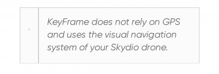
I found this on the Skydio site. It implies no GPS is involved but perhaps that means it’s not REQUIRED. Wording is a little strange.

F58E5312-8977-42E7-9384-BAEC8489E73F.jpeg
It was in this article.

 
Last edited:
The SkydioPilots server seems to be a bit off in the last few days. I getting some error messages so if my post above looks a bit weird it’s because I had quite a challenge getting it to actually post.
 
  • Like
Reactions: mswlogo
Tried out the Keyframes skill again using the same location over the river as last time. I used my launch point as the first Keyframe, giving the Skydio plenty of time to properly acquire satellites, then made a series of points out to the center of the river and flew the same route I used last Friday.

This time the Skydio flew the route in reverse admirably and stopped right at my launch point. I then flew the mission in a forward direction and the Skydio did well for the first 3/4 of the flight then decided to tangle with a white birch tree on the riverbank instead of rolling the route I had plotted down the middle of the river. I am at a loss as to how to keep the Keyframes from drifting. Again there is still the possibility that there are not enough features over the water for the Skydio to follow a proper course but it could be cured by allowing the initial path to be locked so the drone doesn't pick a different path latter.
Well that certainly sounds like progress!👍

Is the first keyframe at launch point before you actually take off (not even sure if that’s possible) or after the launch where the S2 goes up and hovers?

It seems really strange that the backward (rewind) was all good and then went wonky on the forward pass. What’s up with that???

The only thing I can think of is the visual part of the reference of moving water had changed enough to throw it off??? Maybe???
 
  • Like
Reactions: RiverEagle
Tried out the Keyframes skill again using the same location over the river as last time. I used my launch point as the first Keyframe, giving the Skydio plenty of time to properly acquire satellites, then made a series of points out to the center of the river and flew the same route I used last Friday.

This time the Skydio flew the route in reverse admirably and stopped right at my launch point. I then flew the mission in a forward direction and the Skydio did well for the first 3/4 of the flight then decided to tangle with a white birch tree on the riverbank instead of rolling the route I had plotted down the middle of the river. I am at a loss as to how to keep the Keyframes from drifting. Again there is still the possibility that there are not enough features over the water for the Skydio to follow a proper course but it could be cured by allowing the initial path to be locked so the drone doesn't pick a different path latter.

As a process of elimination have you tried doing the same Keyframes process over regular land (perhaps with some recognizable features) and see if it deviates still?

Ray
 
As a process of elimination have you tried doing the same Keyframes process over regular land (perhaps with some recognizable features) and see if it deviates still?
Not yet.... that test is coming but temperatures are hovering around freezing and the most significant feature around is snow.
 
Was watching Skydio marketing guy Kendall Martin's great KeyFrame video on YouTube. in the comment section I found a reply he made indicating that KeyFrames are all vision based and not GPS involved. This would explain the lack of the ability to repeat the exact path over water that I am experiencing. The Skydio 2 would need to have a pretty well defined environment to be able to follow the same path on repeat flights so nearly featureless and moving water areas would be a serious impediment.
Screen Shot 2022-01-16 at 7.15.02 AM.png
 
Was watching Skydio marketing guy Kendall Martin's great KeyFrame video on YouTube. in the comment section I found a reply he made indicating that KeyFrames are all vision based and not GPS involved. This would explain the lack of the ability to repeat the exact path over water that I am experiencing. The Skydio 2 would need to have a pretty well defined environment to be able to follow the same path on repeat flights so nearly featureless and moving water areas would be a serious impediment.
View attachment 626
That’s a really interesting find.

How does it know where the next image (KeyFrame) is to go too.

I can see it using Vision to assist. But no GPS or Compass seems hard to believe.

I would think, things like a tunnel, tower etc. would be confusing.

It may also record all the moves and just reverse them.
 
That’s a really interesting find.

How does it know where the next image (KeyFrame) is to go too.

I can see it using Vision to assist. But no GPS or Compass seems hard to believe.

I would think, things like a tunnel, tower etc. would be confusing.

The Skydio has no compass. That was to protect it from being affected by magnetic interference.

By vision, it he means using the camera and obstacle avoidance sensors. They create a 3d heat map of the world which determines its path. The Skydio must save its 3d path and attempt to duplicate its path and environment on subsequent flights. I would guess that means water, windy conditions, changing light and other moving variables would all affect the repeatability of a path.

It may also record all the moves and just reverse them.
It is supposed to record the location of the Keyframes but in my experience their position drifts if you go back and forth over the course recorded.

The path between KeyFrames definitely changes every time you run the course.

Its a great feature that can use some enhancement.
 
  • Like
Reactions: Sky Cyclist
Was watching Skydio marketing guy Kendall Martin's great KeyFrame video on YouTube. in the comment section I found a reply he made indicating that KeyFrames are all vision based and not GPS involved. This would explain the lack of the ability to repeat the exact path over water that I am experiencing. The Skydio 2 would need to have a pretty well defined environment to be able to follow the same path on repeat flights so nearly featureless and moving water areas would be a serious impediment.

Very interesting find! It does make sense given that GPS accuracy is around 20 feet give or take so there would be more variance in flight paths using it.

It also explains more variance over water since there’s obviously less visual matter to lock/map on to…
 
  • Like
Reactions: kgilbertsen
That’s a really interesting find.

How does it know where the next image (KeyFrame) is to go too.

I can see it using Vision to assist. But no GPS or Compass seems hard to believe.

I would think, things like a tunnel, tower etc. would be confusing.

It may also record all the moves and just reverse them.
That explains indeed that you have to place on the exact point where the last time it took off. I wonder how they compensate for light diffrences …
 
HI...perhaps what I am about to ask has already been written in this discussion, but I haven't found a clear answer: What happens if during the execution of a keyframe mission the skydio gets disconnected? DJI drones for example, in waypoint mode, continue their mission even if they lose connection, it is very important for me to have this detail clear ... thanks
 
  • Like
Reactions: mswlogo
HI...perhaps what I am about to ask has already been written in this discussion, but I haven't found a clear answer: What happens if during the execution of a keyframe mission the skydio gets disconnected? DJI drones for example, in waypoint mode, continue their mission even if they lose connection, it is very important for me to have this detail clear ... thanks

Let's discuss it in detail, this will be discussed in two cases:

Case#1. During the keyframe setting -- it will return and the keyframe settings can be recovered. You don't need to set all of the frames from the beginning. In other words, the settnig can't be completed if the connection is lost.

Case#2. During the keyframe flight -- it will continue if the connection is recovered in seconds.

Since the keyframe's setting is not done offline, it requires flying the drone to the exact location and setting the frame, a lost connection would not happen normally. Although, the connection could be a little bit unstable during the keyframe execution. (Case#1)

~~~~~~~~~~~~~~~~~~~~~~~~~~~~~~~~~~~~~~~~~~

Although both of them are drones, they are very different.

KeyFrame and Waypoint are very different, too.

If you want to use Skydio 2 happily, there is a way, don't imagine it too much, but use its strengths.

Hope this is helpful.
 
Last edited:
Let's discuss it in detail, this will be discussed in two cases:

Case#1. During the keyframe setting -- it will return and the keyframe settings can be recovered. You don't need to set all of the frames from the beginning. In other words, the settnig can't be completed if the connection is lost.

Case#2. During the keyframe flight -- it will continue if the connection is recovered in seconds.

Since the keyframe's setting is not done offline, it requires flying the drone to the exact location and setting the frame, a lost connection would not happen normally. Although, the connection could be a little bit unstable during the keyframe execution. (Case#1)

~~~~~~~~~~~~~~~~~~~~~~~~~~~~~~~~~~~~~~~~~~

Although both of them are drones, they are very different.

KeyFrame and Waypoint are very different, too.

If you want to use Skydio 2 happily, there is a way, don't imagine it too much, but use its strengths.

Hope this is helpful.
thankyou..what i have in mind is to do an inspection around a building, i have the skydio2, not the skydio2 +, and i know how fragile the connection is when it is on the other side of the building, so i thought i would follow it around the building while setting the mission, then go back to the starting point and let it execute the mission.....
 
  • Like
Reactions: Sky Cyclist

New Posts

Members online

No members online now.

Forum statistics

Threads
1,662
Messages
12,656
Members
2,536
Latest member
ecs132